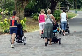
Walk maps might be the key to accurately recording your New Year fitness goals. When Dara and I first discussed a fitness post we came up with the idea to write about the top parks for exercise in Orange County. Predictable? Yes. But exercising outdoors equals playing outdoors in our minds – so we decided to suggest some places to go.
THE #1 PARK ON OUR LIST
Whichever park is closest to you. Just getting outdoors and playing with your kids will make you feel more mentally and physically fit. The closest parks to us, may not be the closest to you.
What if you could figure out the distance from walk maps? We recently got a question from a reader about the walking distance around a park loop. Mr. Play Parks and I figured out the distance using Google Earth, but it turns out there’s a website designed just for this. It’s called MapMyWalk.com. Looks like it has all sorts of training guides and ways to log your progress, including an iPhone app called iMapMyWalk which could be cool.
Let’s use Dara’s picks to test out Map My Walk:
Mandeville Park
There is a nice sidewalk loop for walking/running or pushing a stroller. You can keep an eye on older kids as they play on the equipment while walking the loop. There are also some designated exercise stops along the path: pull-up bars, a plank for sit-ups and graduated circle platforms. (Short walk at .2 miles around the outside loop).
Laguna Niguel Regional Park
A bike ride or hike around the lake is definitely a great way to get your heart pumping. I would not suggest the bike ride for little kids who just learning to ride their bikes. There are a few hills and some uneven parts on the trail. (It says 1.3 miles around the lake.)
Sheep Hills Park
Plenty of open grassy area to play football and soccer. The hill leading down to the park provides a great workout if you walk up and down it a few times. There is also an entrance to the Aliso/Wood Canyon trail which is great for biking, hiking or jogging. (If you start at the top of the hill as Dara suggests, do a loop around and end up back at your car it looks like it’s 1/2 mile.)
It’s not an entirely intuitive tool. You’d probably get the most benefit by registering for free so you can save routes. I mapped the walks above without registering. The biggest tip I could give would be to collapse the window on the left and select “Satellite View” so you can actually see the sidewalk and map the route you would walk. Please leave a comment if you know of other useful tools.
*No compensation has been received for this post – I’m just a nerd who gets excited about gadgets like this and wanted to share. Happy walking!


Tiny Oranges
Sunday 10th of January 2010
Cool site! Thanks for sharing! I always wonder how far I am actually walking. This is awesome!
Gigi
Sunday 10th of January 2010
Things don't turn up in this world until somebody turns them up - James Garfield Keep playing and passing on your great ideas!
Debi
Saturday 9th of January 2010
I was just thinking of ways to incorporate the outdoors into my fitness routine. Monday I'll be checking out the park closest to me for a walk. Thanks for the great idea!
Maria
Saturday 9th of January 2010
I usually walk the park loops, then go out for more on the nearby streets. I'll have to give MMW a try - I have other GPS-type apps on my iPhone, and I've run into problems when the GPS signal is weak. I've been pretty satisfied using dailymile.com though (which allows you to map your walk using Google maps) - just have to remember your route and enter it afterward though.